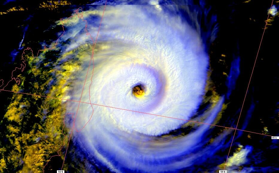
Cyclone tropical intense
🌀 Le système INDLALA a été baptisé le 12.03.2007 à 00 UTC, il a atteint le stade de Cyclone tropical intense.
🌀 Le vent moyen en mer (sur 1 min) a vraisemblablement atteint 213 km/h avec des rafales à 264 km/h.
🌀 Une terre a été impactée par ce météore.